top of page

Industry
3D Imaging
Aerial imaging enables the creation of a 3D model of your site allowing for inspection through zoom in/out and rotation controls.

Site Photography
Monitor the state of your project site over time by reviewing and comparing aerial images and video.

Site Measurements
Obtain distance, volume and area measurements simply and with accuracy.

Elevation
Pre/post site development identify the elevation of the terrain.

Agri Health
Monitor the health of your site vegetation.

Marketing
Aerial photos and video will set your project apart from your competition while demonstrating to your capabilities to your clients.
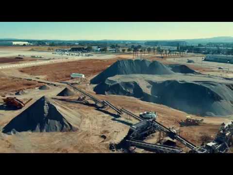
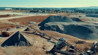
Crushing Concrete by Drone | DJI Inspire 2 X5S
01:51
Play Video
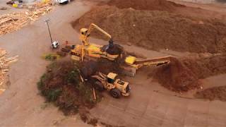
Green Waste Recycle by Drone | DJI Inspire 2 X5S
00:40
Play Video
Video
Photo
bottom of page